
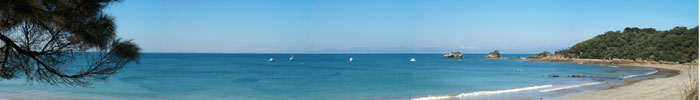
| Wherever you are in
Walkerville, the peaks and islands of Wilsons Promontory National Park
dominate the horizon.
This idyllic coastal settlement,
formerly known as Waratah, is located at the south-western end of Waratah Bay
and once was one of the busiest places in South Gippsland.
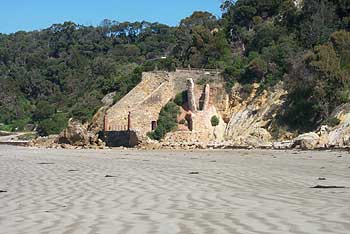
Remnants of the kilns that supplied quick lime to the Melbourne building industry between 1875 and 1926 can still be seen
on the foreshore and are currently being restored by a traditional
stone-mason.
|
|
|
In its heyday the Waratah lime industry used to support about 80 workers and their families who lived in cottages and were served by a general store, a post office and a coffee palace.
Today Walkerville still features stunning coastal views and great swimming and
fishing spots, as well as a caravan park and a kiosk right next to the beach.
|
|
|
| Walkerville is
surrounded by the 4,175-hectare Cape Liptrap,Coastal Park, which extends
from Waratah Bay to the east to the sand barrier of Point Smythe to the
west.
The Park boasts extensive coastal
heathlands of scented paperbark, common heath, several varieties of
she-oaks, silver banksia, bushy hakea and prickly tea-tree.
It is home to wombats, wallabies,
koalas, echidnas and the rare swamp antechinus, as well as many types of
native birds, such as wrens, crimson rosellas, pied currawongs and the
eastern whipbird.
Along the beach look for Pacific and
silver gulls, sooty oyster-catchers, herons, cormorants and Australian
gannets.
|
 |
| There are a number of
walking and fire access tracks within the Cape Liptrap Coastal Park, and
the adventurous will enjoy rock-hopping at low tide along the coast from
Walkerville South to Bear Gully.
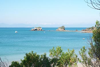
A 1.2-kilometre walking track starts
at the Walkerville North caravan park and leads to the Promontory View
housing estate to the north.
The track passes through scenic
coastal woodlands with a diverse understorey of smaller native plants. A
700-metre side track takes walkers to a viewing platform overlooking
Waratah Bay, with the Prom in the background.
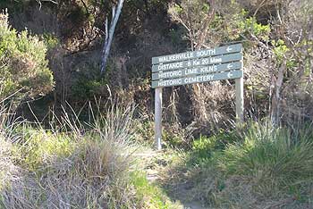
| Another path the
800-metre Walkerville North - South Link Track combines coastal
scenery and vegetation with local history.
The track winds its way over
the Bluff past stands of drooping she-oak, dramatic rock formations,
the Walkerville cemetery and the ruins of four lime kilns. |
 |
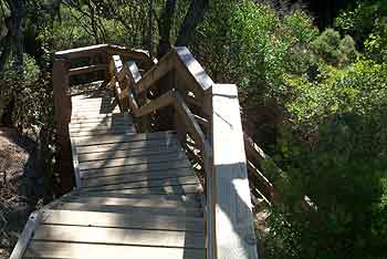
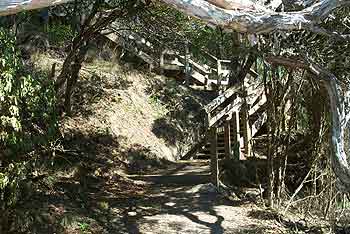
| The track has been
recently upgraded by Parks Victoria and now includes flights of
timber steps traversing some of the steeper sections.
The steps also help to prevent
erosion and afford further protection to the fragile coastal
environment. |
 |
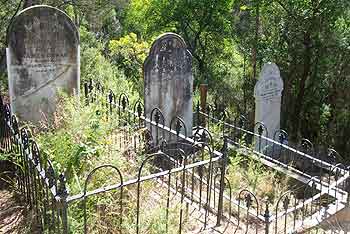
| A highlight of the
Walkerville North-South Link Track is the historic Walkerville
cemetery where the graves of people from early settlers' and
lime-burners' families may be seen.
Most of the epitaphs on the
weather-worn headstones are still legible and can tell an evocative
tale of the people who lived, worked and died in the district. |
 |
| The track allows
walkers to see the natural environment of the Walkerville district
at its best.
Mature coastal vegetation
affords protection from the winds that blow in from across Waratah
Bay but still presents post-card glimpses of the sea. |
 |
| The Walkerville
district is famous for its rock formations, which have been
described as one of the most interesting and complex geological
sequences in Victoria.
Walkerville's land forms
include rock platforms, steep cliffs, sea caves, rock stacks like
Bird Rock and sandy beaches. |
 |
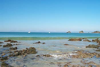
| The beach at
Walkerville North varies from sandy sections to rocky platforms
dotted with pools filled with marine animals and plants.
At low tide the sea recedes,
living behind miniature marine ecosystems in each rockpool.
At
high tide, the sea almost reaches the rock wall bordering Bayside
Drive. |
 |
|
|
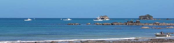
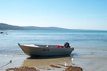
| The Walkerville
district is renowned for its fishing, from the beach and the many
rock ledges to be found there, and also out on Waratah Bay.
Boats may be launched from the
beach at Walkerville North. |
 |
|
|